Tre Cime Viewpoints, Sunrise and Sunset: Where to See and Photograph the Three Peaks
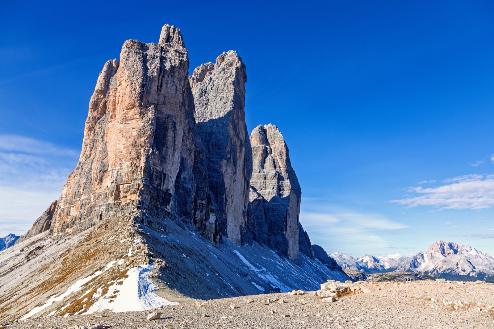
The view everyone wants of the Tre Cime di Lavaredo is the one from the north: the three sheer north faces standing side by side, seen from Rifugio Locatelli (the Dreizinnenhütte, 2,405 m), about 1 hour 20 minutes’ walk from the car park at Rifugio Auronzo. But it is not the only great view. From the road at Landro you see the same north faces across the valley without leaving the car; at Lake Antorno, just above Misurina, the towers are reflected in the water, a favourite of photographers at sunset; and from the Cadini di Misurina viewpoint, Monte Piana and the Sextner Stein you see the peaks from angles most visitors never find. To be at any of the high viewpoints for sunrise or sunset, you need either a night in a hut or an early access slot at the car park, because the shuttles and the Monte Piana jeep run only by day.
This guide goes through the viewpoints one by one — what you see, how to get there and how much effort it takes — and then explains how to plan for the first and last light.
The viewpoints at a glance
| Viewpoint | What you see | Effort |
|---|---|---|
| Rifugio Locatelli | The three north faces side by side | About 1 hour 20 minutes from Rifugio Auronzo |
| Sextner Stein | The north faces up close, with the Paterno | Above Rifugio Locatelli; a full day from the Fiscalina valley |
| Three Peaks view, Landro | The north faces across the Rienza valley | Roadside, with parking |
| Lake Antorno | The peaks reflected in a small lake | Roadside, with a parking area |
| Rifugio Auronzo | The south faces directly above | At the car park |
| Cadini di Misurina viewpoint | The Cadini spires, with the Tre Cime behind you | About 3.2 km return from Rifugio Auronzo |
| Monte Piana | The peaks from the west, with the Paterno | Jeep from Misurina, or a walk |
| Plätzwiese | The peaks on the horizon, with the Hohe Gaisl and the Tofane | Bus or limited parking |
Rifugio Locatelli: the north faces
This is the classic view. From the hut and the small plateau around it, at 2,405 m on the Toblinger Riedl, you look straight at the three north faces, the Cima Grande in the middle at 2,999 m flanked by the Cima Ovest and the Cima Piccola. The local tourist board calls it one of the most spectacular views of the Three Peaks, and the shuttle operator from Dobbiaco notes that the finest view of the peaks comes after about two hours’ walk, at Rifugio Locatelli on path 101.
Getting there: from Rifugio Auronzo, follow the flat path 101 past Rifugio Lavaredo and climb to Forcella Lavaredo, where the north faces come into view; then continue down and round to the hut. Wikipedia gives about 1 hour 20 minutes from the car park. From the valleys, the hut is the end point of the routes up the Rienza valley from Landro, the Val Campo di Dentro and the Fiscalina valley.
Foregrounds: beside the hut are a small chapel and two small lakes, the laghi dei Piani (Bödenseen), which give the view a foreground.
Best light: the north faces stay in shadow for most of the day. Early and late in the day, especially in midsummer, low sunlight can catch the edges of the towers and the sky behind them. The only practical way to be here at those hours is to sleep at the hut or at one nearby — see our guide to the Tre Cime huts.
The Sextner Stein
Above Rifugio Locatelli rises the Sextner Stein (Sasso di Sesto). From its top, the tourist board says, the view opens directly onto the north faces of the Three Peaks, with the Paternkofel (Monte Paterno) rising beside them like a stone tower. It is the closest of the northern viewpoints.
As a day walk from the Fiscalina valley it is long — 16.6 km return, 6 hours 25 minutes, 1,071 m of ascent — but from Rifugio Locatelli it is a short extra climb. Details of the routes are in our guide to hiking to the Tre Cime from the valleys.
The Three Peaks view at Landro
On the road from Dobbiaco to Cortina, at Landro, is the spot the tourist board simply calls the view of the Three Peaks. Here, for the first time, you see the north faces across the Rienza valley. Parking places are available, and it is also the start of the walk up path 102 through the Rienza valley to Rifugio Locatelli: 7.8 km and about 3 hours 30 minutes, with 973 m of ascent.
Why go: it is the easiest view of the north faces in the whole area. You can stop on the way between Dobbiaco and Cortina, or on the shuttle 444 route, which passes near Lake Landro.
Best light: the view looks east up the valley towards the peaks, so the morning sun is behind them; late in the day, the light comes from behind you.
Lake Antorno: reflections
Lake Antorno lies at 1,866 m, just above Misurina on the road to the toll gate. Its calm water reflects the Tre Cime, and the municipality’s own page says it is a favourite of photographers, with spectacular scenes at sunset or when the lake is covered in snow. It is also far less crowded than Lake Misurina.
Practical:
- Access is free, with a parking area right in front of the lake.
- It is less than a kilometre from the toll booth of the Tre Cime road.
- An easy walk of about 500 m circles the lake, suitable for everyone.
- The Dolomiti Bus shuttle between Misurina and Rifugio Auronzo stops here.
- A chalet with a panoramic terrace stands in front of the lake.
Why it matters for photographers: it is the only one of the classic views that needs no walk, no booking and no early shuttle, so it is the obvious place for an evening shot.
Rifugio Auronzo: the south faces
Most visitors’ first view is from the car park at Rifugio Auronzo, at 2,333 m, directly below the south faces. From here the towers look close and massive. The hut’s panoramic terrace, with about forty seats, looks the other way, towards the Cadini di Misurina and the Cristallo — worth a look in the evening when the light falls on those groups.
If you stay at Rifugio Auronzo or Rifugio Lavaredo, 20 minutes further on, you are below the south faces at first light without any walk in the dark.
The Cadini di Misurina viewpoint
The most photographed view near the Tre Cime is not of the Tre Cime at all. From the rocky promontory on path 117, opposite Rifugio Auronzo, you look out over the jagged spires of the Cadini di Misurina, and behind you is the south face of the Tre Cime.
- Distance: about 3.2 km return from Rifugio Auronzo.
- Ascent: about 210 m.
- Time: 1 to 2 hours return.
- Difficulty: no technical difficulty, but the path is narrow and exposed in places and not recommended for people who suffer from vertigo.
After about 30–40 minutes’ walking you reach a small saddle, and a short detour to the left leads to the viewpoint. More detail, including safety on the ledge, is in our article on the Cadini di Misurina viewpoint.
Forcella Lavaredo
On the loop from Rifugio Auronzo, Forcella Lavaredo is where the scene changes: you cross from the south side to the north, and the three north faces appear side by side for the first time. It is the natural first stop for photographs on the Tre Cime loop walk, and the view is the same as from Rifugio Locatelli, only closer and at a sharper angle.
Monte Piana: the view from the west
Monte Piana, the First World War battlefield north of Misurina, has a 360-degree view that takes in the Tre Cime, the Paterno, the Cadini di Misurina, the Sorapiss, the Cristallo and the Croda Rossa, with Lake Misurina at its feet. From the plateau you see the three towers from the west, with Monte Paterno beside them.
The jeep shuttle from the Genzianella in Misurina to Rifugio Bosi ran every day from 1 June to 31 October in 2026, from 9.00 to 17.00, at least every 20 minutes, for €17 one way or €25 return. For early or late light you have to walk; from Lake Antorno it takes about 2½ hours. Our guide to Monte Piana covers the routes and the open-air museum.
Plätzwiese: the peaks on the horizon
The Plätzwiese (Prato Piazza) high plateau, at around 2,000 m in the Fanes-Sennes-Prags Nature Park, is a wide alpine meadow with views of the Hohe Gaisl, the Dürrenstein, the Tofane and, in the distance, the Three Peaks. It is a different kind of view: the towers small on the horizon, with meadows in front.
- By car: via the toll road from Brückele in the Braies valley. Access is usually permitted only before 10:00 a.m. and after 3:00 p.m., parking on the plateau is limited, and the road closes when it is full.
- By bus: route 443 from Dobbiaco, Monguelfo or Villabassa, with a direct service in summer.
- On foot: about 2.5 hours from Brückele.
The car rules make it one of the few viewpoints where an evening visit is actually the easier one.
Planning for sunrise
To photograph the Tre Cime at first light you need to be on the spot before the sun rises, and there are only three ways to do it.
Sleep at a hut. The simplest. At Rifugio Lavaredo breakfast is served from 7:00 to 8:30, and the hut prepares a takeaway breakfast for early departures if you ask the evening before. Rifugio Locatelli puts you in front of the north faces; Rifugio Auronzo and Rifugio Lavaredo under the south faces. All need booking well ahead.
Drive up on an early slot. The car park at Rifugio Auronzo works on online bookings with a chosen access time, and the gate will not open before your booked time. Book the earliest slot you need, and remember that the ticket lasts 12 hours. The tourist board advises arriving before 7.00 in high season in any case, because the car park fills quickly. All the rules are in our Tre Cime parking guide.
Walk up in the dark. Only for experienced walkers who know the route. From the car park at Lake Antorno or from Landro, it means hours of walking by head torch.
The buses are no help for sunrise: the Dolomiti Bus shuttle from Misurina runs from 7.30, and shuttle 444 from Dobbiaco runs by day only.
Planning for sunset
Sunset is easier, because you can stay up and come down in the dusk.
- With a car: your 12-hour ticket must cover the time you leave, and leaving late without booking another slot costs a penalty of twice the single parking rate. Choose your access time with the evening in mind.
- By bus: the Dolomiti Bus shuttle runs until 20.00. In high summer that is before sunset, so check the last departure on the day.
- At a hut: dinner at Rifugio Lavaredo is from 19:00 to 20:00, and the evening light comes after it.
- At Lake Antorno: the lowest-effort sunset in the area, with a parking area by the lake and the reflection of the peaks.
Walking in the dark
If you plan to walk before sunrise or after sunset:
- Carry a head torch and spare batteries.
- Know the route in daylight first; the paths around the peaks are wide, but the scree and the steps on the valley routes are not.
- Avoid the narrow ledge on the way to the Cadini viewpoint in the dark.
- Carry warm clothes: even in July, the early morning at 2,405 m by Rifugio Locatelli is cold. Our Tre Cime weather page shows what to expect.
- Tell someone where you are going.
The seasons for photographs
- Late May and June: the road opens, the high huts usually open from mid- or late June, and snow often lingers on the north side and in the gullies.
- July and August: the longest days and the most people; afternoon storms are common.
- September: clearer air, fewer people, and the best summer walking conditions around Auronzo usually last until early September.
- October: the road usually stays open until late October, weather permitting, but most huts close in late September or early October.
- Winter: the toll road is closed. Lake Antorno, covered in snow, is a classic winter view, and snowmobiles and walkers follow a route of about 4.5 km from the lake to Rifugio Auronzo, which in winter usually opens only at weekends, with just its bar and restaurant.
Respecting the place
- Stay on the paths. The ground around the peaks is fragile, and short cuts cause erosion.
- No camping at the car park: you may sleep inside your vehicle, but setting up tables, chairs or awnings is prohibited.
- Check the rules before flying a drone. Rules differ across the provinces and protected areas around the peaks; at nearby Lake Braies, for example, drones are forbidden.
- Take your rubbish down with you.
If you are visiting from Venice for the day, the light will be the middle of the day, but the day trips on our tours page still reach the views from Rifugio Auronzo and the lakes.
Frequently asked questions
Where is the best view of the Tre Cime?
The classic view of the three north faces side by side is from Rifugio Locatelli, about 1 hour 20 minutes’ walk from the car park at Rifugio Auronzo. From the road, the best view is at Landro, on the way from Dobbiaco to Cortina.
Can you see the Tre Cime at sunrise?
Yes, but you have to be there before the buses start: either sleep in a hut or book an early access slot at the car park, which lets you in from the booked time.
Where is the best place to photograph the Tre Cime at sunset?
Lake Antorno, where the water reflects the peaks, is the easiest. For the north faces, stay at Rifugio Locatelli.
Is the Cadini di Misurina viewpoint at the Tre Cime?
It is close by. Path 117 starts opposite Rifugio Auronzo, and the walk to the viewpoint and back is about 3.2 km. The view is of the Cadini spires, with the Tre Cime behind you.
Can you see the Tre Cime from the road?
Yes. At the Three Peaks view at Landro, on the Dobbiaco–Cortina road, and at Lake Antorno, on the road from Misurina to the toll gate.