Places
Lago di Sorapis: Path 215 from Passo Tre Croci, Ladders and the Hut
Lago di Sorapis is a small turquoise lake at about 1,923 metres, set in a bowl of cliffs on the north side of the Sorapiss group near Cortina d’Ampezzo. The usual way there is path 215 from Passo Tre Croci (1,805 m), the pass on the road between Cortina and Misurina. It is not a long walk: the route card by mountain guide Enrico Maioni on PlanetMountain gives 5.2 km each way and about 2 hours up, and Cortina’s tourist board gives 4 hours for the round trip.
What makes it serious is a short stretch of metal ladders and an exposed ledge fitted with cables. It is not technically difficult, but it is not suitable for people who suffer from vertigo, and Cortina’s tourist board rates the walk as a path for experts. At the end, Rifugio Vandelli, a mountain hut of the Venice section of the Italian Alpine Club (CAI), stands a few minutes from the lake and opens from 20 June to 20 September. This guide covers the route, the times, the exposed sections, parking, the hut, the rules at the lake and how to fit it around a visit to the Tre Cime.
Lago di Sorapis at a glance
- Start: Passo Tre Croci, 1,805 m, on the SR 48 between Cortina and Misurina.
- Path: CAI 215, signposted to Rifugio Vandelli.
- Distance: 5.2 km each way on the PlanetMountain route card; Cortina’s tourist board lists the round trip at 10.5 km.
- Climb: about 220 m of ascent on the way in, with ups and downs; 434 m in total for the round trip, in the tourist board’s figure.
- Time: from 1 hour 30 minutes to 2 hours 30 minutes each way, depending on the source (see below); 4 hours for the round trip in the tourist board’s figure.
- Difficulty: no real technical difficulty, but ladders and exposed, cabled sections; not for anyone who suffers from vertigo.
- Hut: Rifugio Vandelli, 1,926 m, open 20 June to 20 September.
- At the lake: no swimming, no camping, no litter.
Where it is, and how it relates to the Tre Cime
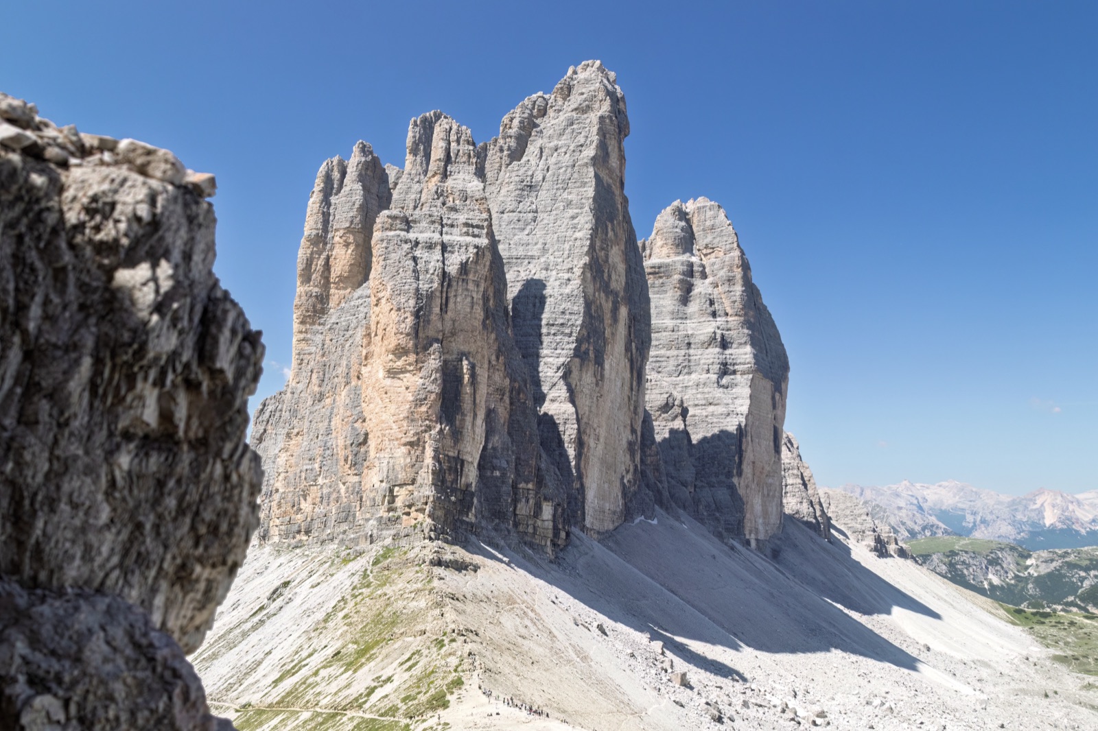
The lake lies in the municipality of Cortina d’Ampezzo, on land owned by the Regole d’Ampezzo, the historic common-land communities of the Ampezzo valley. It is not part of the Tre Cime, but the two are close neighbours. From the hut you look north to the Tre Cime and down to Misurina and its lake, and the path itself has views of the Cristallo, Popena, the Cadini di Misurina and the Tre Cime.
The link is the road. Passo Tre Croci is on State Road 48, which crosses the pass from Cortina to Misurina; auronzo.info puts Misurina about 30 minutes’ drive from Cortina over the pass. From Misurina, the booked toll road climbs to Rifugio Auronzo, the start of the Tre Cime loop. So the Sorapis trailhead is on the way from Cortina to the Tre Cime, but the two walks are separate outings.
Local legend ties the two lakes together. In the story told at Misurina, King Sorapis let himself be turned into a mountain to grant his spoilt daughter Misurina her wish, and his tears formed Lake Misurina below.
Path 215 from Passo Tre Croci: the route
Finding the start
From Cortina, drive up the SR 48 to Passo Tre Croci and continue about 200 m to the signed start of the path. The route is well marked: follow signs for Rifugio Vandelli and path number 215.
Through the woods
The first half is gentle. You set off slightly downhill on a forest track that soon becomes a path, and then walk through the woods with small ups and downs at the foot of the Cime di Malquoira. Cortina’s tourist board describes this part as varied and panoramic, with only a slight overall climb.
The ladders and the ledge
After about an hour’s walk, a metal staircase with a handrail gains height. It is safe, but its height and exposure can unsettle people who dislike heights, and PlanetMountain’s route card notes that this is where the first hold-ups form. Beyond it, the path is partly cut into the rock of a steep buttress. Another exposed stretch, fitted with a wire rope, marks the end of the difficulties. Cortina’s tourist board describes the same section as some metal ladders and exposed sections along a level ledge, fitted with metal cables.
The last stretch
After the cables, the path climbs gently through scattered larches and dwarf pines to Rifugio Vandelli. Just before the hut, signs point to the lake, which is only a moment away. It appears suddenly, in a hollow below the cliffs.
Coming back
The tourist board advises returning the same way, on path 215. There is a loop through Forcella Malquoira (also spelled Marcoira), but it is only for experienced walkers.
How long does it take?
The sources give different times, and the spread is useful:
- CAI Venezia, which owns the hut, gives 1 hour 30 minutes from Passo Tre Croci on path 215.
- Rifugio Vandelli’s own site gives about 1 hour 45 minutes to 2 hours 30 minutes, and stresses that times are indicative.
- PlanetMountain’s route card gives an average of 2 hours up to the lake.
- Cortina’s tourist board gives 4 hours for the round trip.
The shorter figures are for fit walkers moving steadily. Queues at the ladders, photographs and the time at the lake all add up, so plan on a half-day at least and a full morning in high season.
The exposed sections: who should go
This is the question that matters most. The route has no real technical difficulty, but it includes some exposed sections, and PlanetMountain’s route card is clear that it is not suitable for people who suffer from vertigo or who are uncomfortable when height and exposure are fully felt. Cortina’s tourist board goes further and rates the walk as a path for experts.
In practice:
- Confident hill walkers with a head for heights will find it a straightforward, if busy, half-day.
- Nervous walkers and children: the route card advises a via ferrata kit (harness and lanyards) for children and nervous walkers on the ladders and cables.
- Footwear: trekking shoes and a waterproof, windproof jacket are recommended. The rock is slippery when wet.
- Turning back at the first ladder is a sensible choice if it already feels wrong; the woodland section is pleasant in its own right.
- Weather: avoid the exposed sections in rain, in ice or with a storm building.
Parking at Passo Tre Croci, and the bus
Parking is the other practical problem. There is no car park of an adequate size at the start of the path, and on busy days cars line the road at the pass. PlanetMountain’s route card says it plainly: parking near Passo Tre Croci is crowded, and the author suggests taking the bus from Cortina’s bus station instead.
- By car: arrive early, especially in July and August and at weekends, and park only where it is allowed.
- By bus: the route card’s suggestion is the bus from Cortina’s bus station; check the current Dolomiti Bus summer timetable for services over the pass.
- From Misurina: the pass is on the same road, a short drive away.
Rifugio Vandelli
Rifugio Alfonso Vandelli stands at 1,926 m in the middle of the northern amphitheatre of the Sorapiss, almost on the edge of the rock step where the waterfall spills over. It belongs to the Venice section of CAI and is run by the Pais Bianco family.
- Season: open from 20 June to 20 September. Early or late openings are announced on the hut’s own site.
- Beds: 34, plus 6 in the winter room. Overnight bookings go directly to the hut.
- History: CAI Venezia gives 1966 as its year of construction, while Cortina’s tourist board says the hut was originally built in 1890.
- 2026 notice: because of a water shortage, the hut’s public toilets have been temporarily closed since 13 July 2026, though the hut itself stays open. Check the notices on its site before you go.
Staying the night is the best way to see the lake quietly, at dawn or in the evening, when the day walkers have gone.
The lake itself
Why it is that colour
The colour runs from sky blue to aquamarine, and Cortina’s tourist board explains why: very fine rock powder carried by the Sorapis glacier, whose melt feeds the lake in spring and summer. The water is always cold.
Where the water goes
The lake is cut into the rock and has no surface outlet. Its water flows underground and emerges at a waterfall called el Piss, and the mountain takes its name from it: Sora el Piss means “above the waterfall”.
The mountains around it
The lake sits in a natural amphitheatre of cliffs. The needle directly behind it is the Dito di Dio, the “Finger of God”, at 2,603 m. On the Tre Sorelle, one of the walls around the lake, Emilio Comici and Giordano Bruno Fabjan opened one of the first grade-six climbs in the history of mountaineering in 1929.
Rules at the lake
The hut’s page on the lake is brief and clear:
- No camping.
- No swimming.
- No rubbish of any kind left behind.
Wear proper walking clothes and trekking shoes and watch the weather. The lake is small and heavily visited, and the Regole d’Ampezzo, the forestry police and the hut have all struggled with litter and overcrowding, according to PlanetMountain. Carry everything out with you.
What to bring
- Trekking shoes or boots with a good grip. The ladders, the rock ledge and the roots in the woods are all slippery when wet.
- A waterproof, windproof jacket. The weather can change quickly, and the lake sits in a deep bowl of cliffs on the north side of the mountain.
- Water and snacks. The hut serves food in season, but carry enough for the walk, and remember that its public toilets were closed from 13 July in 2026.
- A via ferrata kit for children or nervous walkers, as the route card advises.
- A bag for your rubbish, to carry everything back down.
- Money for the hut, and a booking if you plan to stay the night.
Photographs
The lake is at its most striking when the water is calm and the light is on the Dito di Dio behind it. Early morning gives the stillest water and the fewest people on the shore; by late morning in high season the lakeside is crowded. On the way in, the open sections above the woods give views back across to the Cristallo, the Cadini and the Tre Cime. Keep well back from the edges on the ledge section when stopping for pictures, and let others pass on the ladders rather than stopping on them.
Other routes to the lake
- From Federavecchia–Valbona on path 217: CAI Venezia gives 1 hour 30 minutes, and this is the only access in winter. The hut’s own figure for this route is longer, so allow extra time.
- The loop via the Laudo and Forcella Malquoira (paths 213, 216 and 215): the hut gives about 3 to 4 hours. PlanetMountain’s author describes the loop as more rewarding but for experienced walkers only.
- Closed paths: after a landslide in the Sorapiss–Croda Marcora area, paths 241 (Dogana Vecchia to the Cengia del Banco) and 242 (the Francesco Berti via ferrata) are closed, under an ordinance of the municipality of San Vito di Cadore dated 18 June 2025. Check the hut’s notices before planning anything beyond the lake.
When to go
- The hut’s season, 20 June to 20 September, is the natural window, with food, drink and shelter at the top. Early in the season, ask the hut about lingering snow on the route.
- Low season and weekdays are best. The route card asks visitors to come in the low season and preferably not at weekends if they can.
- Early starts help in July and August: you get to the ladders before the queues and to the lake before the crowd, although you will still meet plenty of people on the way down.
- Afternoon storms are common in summer in the Dolomites; the exposed sections are no place to be in one.
- Winter is a different undertaking. The only winter access is path 217 from Valbona, and the conditions need mountain experience.
Pairing Lago di Sorapis with the Tre Cime
The Sorapis and the Tre Cime are two of the best-known walks between Cortina and Misurina, and they are easy to combine in a trip, if not in a day.
Two days, not one
Both walks take a morning or more. The Sorapis round trip is 4 hours in the tourist board’s figure, and the Tre Cime loop from Rifugio Auronzo is another 4 hours on paths 101 and 105 by the local tourist board’s count. Add the drive, parking at a crowded pass and a booked slot on the Tre Cime toll road, and one day becomes a race. Give them a day each and choose the clearest one for the Tre Cime.
A sensible two-day plan
- Day one: path 215 to Lago di Sorapis in the morning, lunch at Rifugio Vandelli, back at Passo Tre Croci in the early afternoon, and an evening walk round Lake Misurina.
- Day two: the Tre Cime from Rifugio Auronzo, reached by the booked toll road or a shuttle, with the Cadini di Misurina viewpoint as an add-on.
Our guide to the Tre Cime loop walk covers day two, and the Cadini di Misurina viewpoint is the short walk that starts at the same hut.
Staying nearby
Cortina and Misurina both work as bases, with Passo Tre Croci on the road between them and the Tre Cime toll road starting near Misurina. If you are coming from Venice for a single day, the guided day trips concentrate on viewpoints rather than long walks; our guide to the Tre Cime from Venice explains the options. For company on the Tre Cime side, the small-group hike from Misurina takes up to 4 walkers, and the tours page lists what is running on your dates. For another famous lake in the area, see Lago di Braies.
Frequently asked questions
How long is the hike to Lago di Sorapis?
About 5.2 km each way from Passo Tre Croci on path 215, according to PlanetMountain’s route card, or 10.5 km for the round trip in Cortina’s tourist board’s figure. Times up range from 1 hour 30 minutes (CAI Venezia) to 2 hours 30 minutes (the hut); the tourist board gives 4 hours for the round trip.
Is the Lago di Sorapis hike dangerous?
It has no real technical difficulty, but it includes metal ladders and an exposed ledge with cables, and it is not suitable for people who suffer from vertigo. Cortina’s tourist board rates it as a path for experts. Avoid it in wet or icy weather.
Can you swim in Lago di Sorapis?
No. Swimming is forbidden, as are camping and leaving rubbish. The water is also cold all year, as it comes from the Sorapis glacier.
Where do you park for Lago di Sorapis?
At Passo Tre Croci, on the SR 48 between Cortina and Misurina, where parking is limited and fills early. The route card suggests the bus from Cortina’s bus station instead.
When is Rifugio Vandelli open?
From 20 June to 20 September. In 2026 its public toilets were closed from 13 July because of a water shortage, while the hut stayed open.
Can you do Lago di Sorapis and the Tre Cime in one day?
It is possible for fast walkers with a car, but it makes a very long day: about 4 hours for each walk, plus driving and a booked slot on the Tre Cime toll road. Two separate days are far more enjoyable.